


")


Drawing satellite imagery through gesture


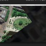
Created by Zach Lieberman in collaboration with Google’s Data Arts team, Land Lines is an experiment that lets you explore Google Earth satellite imagery through gesture. “Draw” to find satellite images that match your every line; “Drag” to create an infinite line of connected rivers, highways and coastlines.
Satellite images provide a wealth of visual data from which we can visualize in interesting ways. Using a combination of machine learning, optimized algorithms, and graphics card power, the experiment is able to run efficiently on your phone’s web browser without a need for backend servers.
The app relies on a number of different technologies to make the magic happen. This includes OpenCV Structured Forests and ImageJ’s Ridge Detection to analyze and identify dominant visual lines in the initial dataset of 50,000+ images. This helped cull down the original dataset to just a few thousand of the most interesting images. For the “draw” application, the team stored the resulting line data in a vantage point tree. This data structure made it fast and easy to find matches from the dataset in real time right in your phone or desktop web browser. They also used Pixi.js, an open source library built upon the WebGL API, to rapidly draw and redraw 2D WebGL graphics without hindering performance. Finally, all images are hosted on Google Cloud Storage so images are served quickly to users.
Source : http://www.creativeapplications.net/js/land-lines-drawing-satellite-imagery-through-gesture/
All images/words © the artist(s) and organization(s)
☆Donation: https://www.paypal.com/paypalme2/artlecture


